At Rinjani Trek Info by Herman Trekker
It’s important to know before making a plan to climb Mount Rinjani is the map trails. Learn and understand about the hiking route to make it easier for you to choose a climbing package that suits your level.
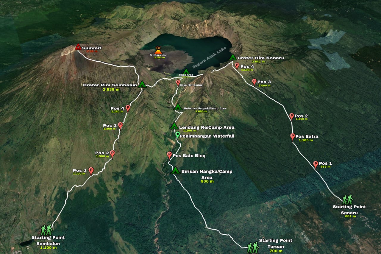
Mount Rinjani is a special mountain among other mountains in Indonesia. Because it not only has the second-highest peak in Indonesia, but also has Segara Anak Lake located at an altitude of 2000 meters above sea level, like a giant reservoir that irrigates the entire area for all people in Lombok Island.
Therefore, many trek routes have been made by the ancestors to get to the peaks and lake.
The hot springs near the lake also become a popular destination after the summit and lake because all climbers can soak and relax cramped muscles after finishing the trek from the peak.
But to avoid danger to climbers from getting lost, Rinjani National Park inaugurated 3 main routes to get to the peak and the lake, and 1 special route only to the lake. The paths are: